The terms “data analytics” and “big data” are becoming commonplace across real sectors as improvements in technology allows various agencies to collect, store & process their data to drive meaningful insights. The permeance of data analytics into conservation efforts has really turned the tables on the illegal trade of endangered animals and animal products. According to Global Environment Facility (GEF), the estimated monetary value of illegal wildlife trade is between $7 and $23 billion per year that is carried out by well-organized international criminal networks, supported by poaching, inadequate enforcement of law and order and compounded by political instability.[1] Prevention of crime and smuggling of forest flora or fauna in the rugged terrain and forest cover is often a challenging task for the team of rangers.
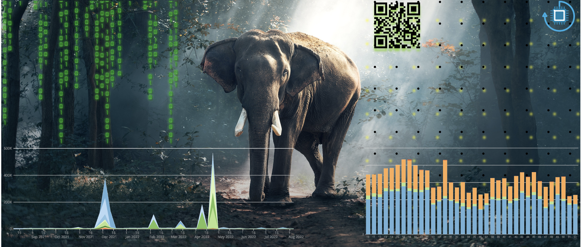
Data from the field often is a mix of structured and unstructured data comprising of images from camera traps, footprints, and even intercepted code language of the poachers. Big data tools have self-learning algorithms to uncover hidden patterns and correlations, leading to interpretations and meaningful conclusions for the enforcement authorities. For instance, imagery from camera traps with geo-spatial information can be relayed by the rangers to their senior officers who can carry out time actions to save the animals and, also arrest the poachers. Cloud technology is helping conservationists deploy it quickly without the need to provision, operate and maintain expensive physical infrastructures. It also enables wide-scale accessibility, helping teams and organizations, spread across vast geographical distances, to share information, collaborate on insights, and unify data sources. Hence, it makes it possible to pool the resources and capabilities together to deliver more significant results to wildlife conservation efforts.
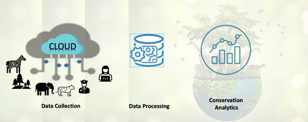
Gartner, a professional research agency envisages a digital platform where a judicious mix of IoT devices, machine learning and cloud technology can accelerate conservation efforts.[2]
AI-enabled technology is helping alert government and wildlife officials to scrape vast amounts of information hidden in the dark web to track and identify illegal wildlife transactions between buyers and sellers. Sensor and analytics technology can also help monitor the health of the species that are bred in captivity, and then released into the wild. IoT technology is used for these sensors to pick up geolocation data as well as data related to blood pressure and pulse, send them to a gateway, then over to the network, and finally integrate it into a platform to provide a unified and clear view. By tracking changing patterns within population data, conservationists can monitor population changes among endangered and critically endangered species. Cloud technology in conservation is also providing ancillary benefits by empowering local communities through tech, it is helping with job creation, as well as to upskill themselves and increase their economic opportunities. By integrating the multiple data points and consolidating a single source of truth, data analytics is helping define management strategies of these wildlife parks, to become more efficient. Google’s Wildlife Insights project leverages AI and cloud technology to process images and other types of field-based sensor data. Classification algorithms are applied on captured data for species types, population, migration routes etc. It provides policymakers with accurate and quality insights at the points of action, through their preferred platforms. Data analytics can be a crucial investment that equips wildlife conservation agencies & governments alike with the right tools in their conservation efforts to ensure a healthy wildlife population for our future generations.[3]
iSeeMammals[4] is one such initiative designed to collect opportunistic species-level data in New York state, United States. iSeeMammals enables members of the public to collect any of three types of data:
- PO data from one-off observations
- PA data from hikes
- PA data from camera traps
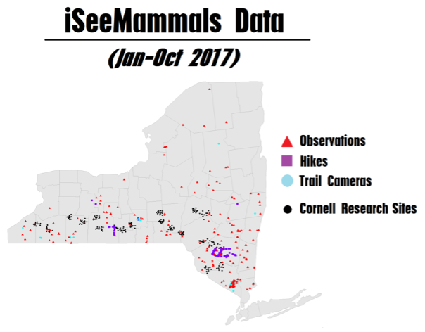
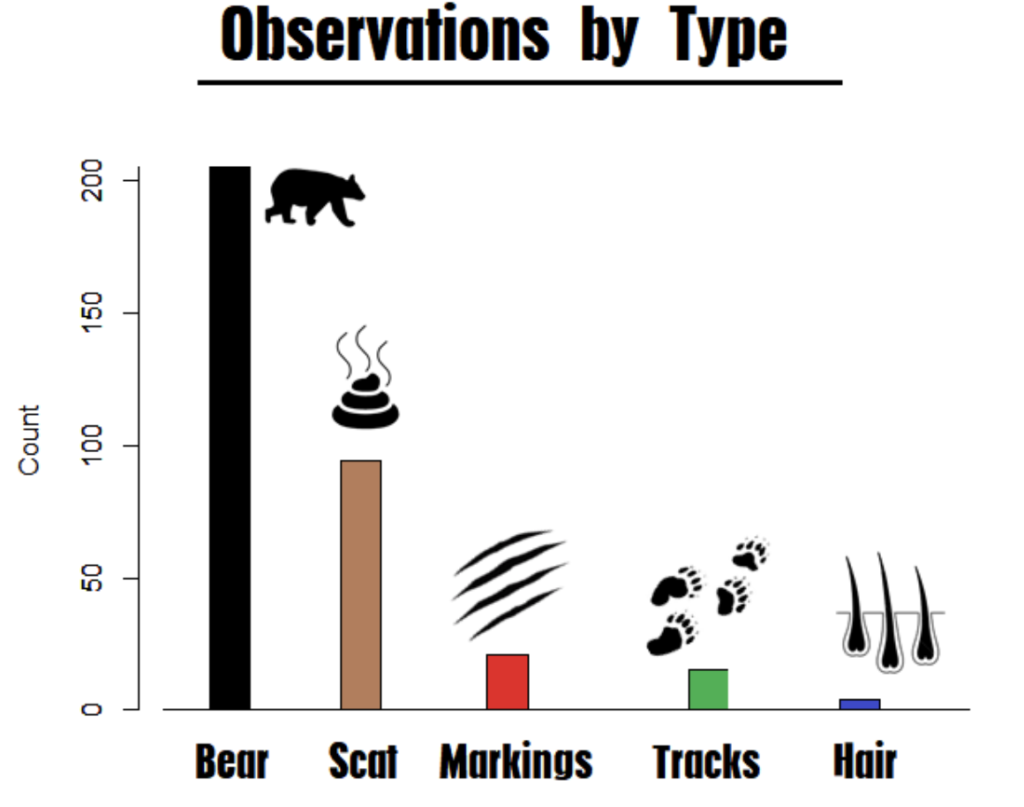
iSeeMammals launched in 2017 and has focused initially on American black bears (Ursus americanus), with the objective of assessing how citizen science efforts could support integrated analyses to improve population abundance estimates. Exploring the feasibility and benefits of a citizen science approach was motivated by logistical and financial limitations of systematic sampling; New York is 141,300 km2 but annual spatial capture-recapture data collection in June—August since 2015 had been restricted to approximately 241 locations in the southern part of the state (40,079 km2) due to its high annual cost of approximately $192,000 USD.

References
[1] Global Environment Facility (www.thegef.org)
[2] Apply Digital Business to Sustainability (www.gartner.com)
[3] Wildlife Insights | Projects | WWF (www.worldwildlife.org)
[4] iSeeMammals – A Citizen Science Project (https://iseemammals.org/)
[5] Frontiers (https://www.frontiersin.org/articles/10.3389/fevo.2021.682124)
Authored by